
Updated by
Cooper Hale is the founder and editor of FIFO Careers. Based in Sydney, Australia, and in his thirties, Cooper researches FIFO and remote-site careers across mining and resources, construction, renewables, oil and gas, healthcare and electrical trades. His guides draw on current job advertisements and authoritative Australian sources, including Fair Work Commission agreements, ATO guidance, modern awards and Fair Work Ombudsman resources. He aims to provide practical, carefully sourced information rather than opinion or unverified forum advice.
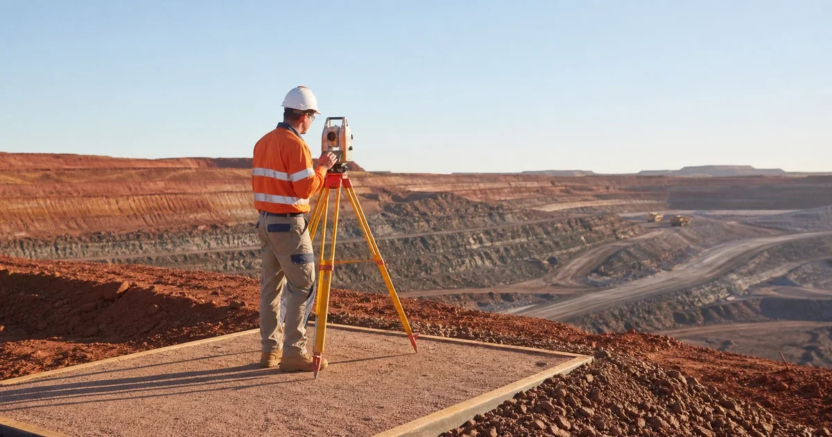
A mining surveyor measures, maps and records the physical mine so that development, production and mine plans are based on reliable spatial information. The role combines field measurements with office-based data checking, modelling, reporting and communication with mining, geology, geotechnical and operations teams.
The title covers several different jobs. Open-pit surveyors may set out designs, measure stockpiles and excavation progress, and update surface models. Underground surveyors may extend survey control, mark development and drilling positions, complete as-built surveys and update underground plans. A surveyor appointed to a statutory or authorised position can also carry formal responsibilities that an entry-level surveyor does not hold.
This guide explains those differences, what FIFO work can involve, how qualifications and registration vary, and how to assess a current vacancy. The job advertisement, employer and relevant state or territory regulator remain the authority for a particular role.
What a mining surveyor actually does
Jobs and Skills Australia describes mine surveyors as professionals who design and measure mines and underground works, map mineral deposits and establish spatial information used in mining decisions. Its task profile includes marking excavation and drill-pattern limits, controlling tunnel direction, establishing horizontal and vertical reference data, calculating moved volumes and using GIS to create mine maps.
A practical way to understand the work is as a control loop:
- Establish control: maintain trusted reference points and confirm that the equipment, coordinates and site control are suitable for the task.
- Set out the plan: transfer an approved design into the field so crews know where development, drilling, excavation or infrastructure should go.
- Measure what happened: capture pickups, as-built positions, surfaces, stockpiles or underground workings after work progresses.
- Check the data: validate measurements, coordinate systems and assumptions before the information is used.
- Update and report: maintain plans and models, calculate relevant quantities and communicate deviations or uncertainties to the people making operational decisions.
- Preserve the record: store data, plans and survey records under site procedures and any applicable statutory requirements.
Accuracy matters, but the job is not performed in isolation. A technically precise measurement can still be unhelpful if it is late, based on the wrong design revision or poorly communicated to the team that needs it.
Open-pit and underground mine surveying are different
Both settings use survey control, field observations, spatial software and careful records. The physical access, production questions and risk controls can be very different.
| Work setting | Typical questions | Work may include | What to clarify in a job ad |
|---|---|---|---|
| Open pit | Where should the next excavation, drill pattern or item of infrastructure go, and what has changed? | Design set-out, surface pickups, stockpile and volume surveys, pit and dump surfaces, as-builts, month-end reporting, GNSS, laser scanning or remotely piloted data capture | Commodity and pit type, construction exposure, field/office split, RPAS expectations and the required authorisation level |
| Underground | Are headings, rises, production holes and services developing in the correct position and direction? | Extending control underground, development and production set-out, pickups, as-builts, void or cavity measurement, underground models, mine plans and emergency-plan updates | Underground experience, shift access, equipment, development versus production work, statutory-plan responsibilities and supervision |
| Projects or construction support | Is new mine infrastructure being built in the approved position? | Control networks, civil set-out, as-constructed records and coordination with engineering or contractors | Whether the role is primarily mine, engineering or construction surveying and which experience is mandatory |
| Graduate, cadet or vacation work | How will supervised experience be built without overstating independent responsibility? | Field assistance, data processing, basic set-out or pickups, equipment care and structured development | Named supervisor, training plan, study requirements, site access and the pathway to greater responsibility |
The Surveyors Board of Queensland career description similarly distinguishes surface work such as excavation limits and blast-pattern marking from underground work controlling tunnel location and direction. Treat these as role families, not a promise that every surveyor performs every task.
What can a mining surveyor's workday look like?
A site-based day usually starts by confirming priorities, access and the current design information. Before entering a work area, the surveyor needs to understand the site's communication, permit, isolation, traffic and other relevant controls. The exact process is site-specific.
Depending on the role and shift, the day could include:
- checking survey control and instrument status before field work
- setting out development, drilling, excavation or infrastructure from an approved design
- collecting pickups or as-built measurements after work is completed
- coordinating access with supervisors and equipment operators
- processing GNSS, total-station, scanning or RPAS data
- comparing the measured result with the design and investigating an unexpected difference
- updating mine plans, surfaces, models or spatial databases
- completing production, reconciliation, month-end or statutory reporting
- handing over incomplete work, control issues and decisions that need follow-up
Current FIFO Careers listings checked on 11 August 2026 reflected that range. An underground role emphasised development and production set-out, control networks, as-builts and the digital underground model. An open-pit FIFO role emphasised new-pit control, infrastructure as-builts, month-end surveys and surface-model updates. These listings will change, so use them as examples of how to read the work rather than permanent requirements.
Mine surveyor, authorised surveyor and statutory surveyor are not interchangeable
“Mining surveyor” can be a job family. “Authorised”, “registered” or “statutory” language can identify a formal credential or appointment with defined responsibilities. Do not assume that completing a course automatically makes a person eligible to certify mine plans or hold a statutory position.
Requirements differ by jurisdiction and mine type. For example:
- Western Australia's WorkSafe statutory-certificate guidance lists authorised mine surveyor certificates at grades 1 and 2 and directs applicants to the eligibility requirements in the WHS Mines Regulations.
- The Surveyors Board of Queensland explains that registration is required to certify mine plans, with the applicable mining competencies or endorsement depending on the work.
That does not mean every junior or supporting survey role requires the highest statutory credential on day one. Current advertisements may ask for an existing authorisation, say it is highly regarded, or accept a candidate who can work towards it under the employer's development structure.
When you see statutory language, check four things separately: the jurisdiction, open-pit or underground scope, the credential or registration named, and whether the position will actually be appointed to a statutory function. Verify the current requirement with the regulator rather than relying on an old advertisement or another state's terminology.
How to become a mining surveyor in Australia
There is no single pathway that fits every vacancy. Jobs and Skills Australia classifies mine surveyor at skill level 1, corresponding to bachelor-level study or an equivalent level of learning and experience. Current advertisements can be more specific: roles checked by FIFO Careers asked for combinations such as a surveying degree, diploma or advanced diploma plus relevant mine experience.
A sensible sequence is:
- Choose the surveying context. Compare mine, engineering, cadastral and general spatial work. A course can cover several areas, but registration and employer expectations are not automatically transferable.
- Check the exact qualification. Review current course subjects, delivery mode, practical work and recognition in the jurisdiction where you intend to work. Curtin's current Bachelor of Mine and Engineering Surveying is one example of a mine-focused degree, not the only possible route.
- Build truthful practical evidence. Field exercises, control checks, data processing, CAD or spatial work, placements and supervised site experience can demonstrate method. Keep student, assistant and independently responsible work clearly separated.
- Target the right vacancy level. Vacation student, cadet, graduate, survey assistant and experienced surveyor roles are not interchangeable. Match the level of supervision and responsibility to your evidence.
- Plan registration or authorisation separately. If your target role involves certified plans or a statutory appointment, use the relevant regulator's current pathway and confirm its education, experience, assessment and maintenance requirements.
- Verify mobilisation requirements. Right-to-work evidence, driver's licence, inductions, medical assessment, drug and alcohol screening and site access requirements vary by employer, role, site and jurisdiction.
Avoid buying a short course or drone credential on the assumption that it guarantees mine-surveying work. First identify the roles you can realistically target and compare their mandatory criteria.
Tools matter, but evidence of judgement matters more
Current advertisements may name GNSS receivers, total stations, laser scanners, RPAS platforms, CAD packages, mine-planning software and point-cloud tools. The software list changes between employers and operations.
When describing your capability, show the task and the check, not just the product name. Stronger evidence sounds like: “processed a supervised control survey, checked closure against the project tolerance and documented the adjustment.” A software-only claim does not show whether you chose the correct coordinate system, validated the data or recognised an unreliable result.
Useful capabilities include:
- spatial reasoning and coordinate-system discipline
- field planning and equipment care
- data validation and traceable file management
- careful set-out and as-built practice
- clear communication with operations and technical teams
- the confidence to stop and resolve unclear design information or unsafe access
- concise reporting and handover
RPAS experience can be valuable in some surface roles, but a remote pilot credential is not a universal mine-surveyor requirement. Treat it as vacancy-specific and verify current aviation, site and employer requirements before relying on it.
Does mine surveying always mean FIFO?
No. Mining surveyors can be FIFO, DIDO or residential, and some project or technical work may be based away from an operating mine. Even at one operation, a vacancy may offer a choice between FIFO and living locally.
For a site role, check:
- the point of hire and who pays each travel leg
- whether the arrangement is FIFO, DIDO or residential
- roster pattern, shift length, nights and call-outs
- open-pit, underground and office time
- whether the role covers one operation or travels between sites
- camp, site transport and communications arrangements
- who provides supervision and who holds any statutory responsibility
Do not infer flights or a roster from the employer name or the word “mining”. If the terms are unfamiliar, compare FIFO, DIDO and BIBO work arrangements before assessing the offer.
How to read a mining-surveyor job ad
Use the advertisement to identify the role's real centre of gravity.
| Ad signal | What it tells you | What to verify or prepare |
|---|---|---|
| Open pit, underground or projects | The physical setting and core survey problems | Direct experience required versus transferable experience; site access and supervision |
| Set-out, pickups, as-builts or control | The field responsibility | A specific example showing method, checks and your actual level of responsibility |
| Mine plans, emergency plans or statutory reporting | Formal record and compliance exposure | Jurisdiction, mine type, named credential and whether appointment is part of the role |
| GNSS, total station, scanner or RPAS | Expected capture platforms | Real use level, calibration/checking practice and any credential explicitly required |
| Deswik, AutoCAD, Civil 3D or another package | Data-processing and reporting environment | Tasks completed, outputs checked and ability to learn a different package |
| Authorised, registered or “working towards” | Expected regulatory standing | Current status, evidence, supervision and a realistic pathway without overstating eligibility |
| FIFO, residential or roster wording | Living and travel arrangement | Point of hire, travel responsibility, shift pattern, nights, accommodation and relocation terms |
On 11 August 2026, the live Mining Surveyor jobs page included underground, open-pit, statutory and vacation-student variants. That mix is the reason to read individual advertisements instead of treating a keyword result as one uniform job.
Is mining surveying likely to suit you?
The work may suit you if you like precise field work and spatial problem-solving, can move comfortably between a mine environment and detailed computer work, and take satisfaction in producing information that other teams can trust. You need patience for control, checking, records and repeat measurements—not only interest in drones or large mining equipment.
Look more carefully before committing if you dislike working to defined tolerances, want every day to be outdoors, or are choosing the field only because you expect a particular FIFO salary or roster. Underground access, early field priorities, month-end deadlines and statutory recordkeeping can change the experience significantly.
If you are comparing technical disciplines, a mining engineer designs and plans mining systems and production decisions, while a mining surveyor establishes and verifies the spatial control and measured record those decisions rely on. The roles work closely together, but one is not a substitute for the other.
Your next step
Choose the action that matches your stage:
- Still choosing study: compare course content, field practice, delivery mode and the registration pathway in your intended jurisdiction.
- Student or graduate: read vacation, cadet and graduate advertisements and map each criterion to truthful coursework, field, project or placement evidence.
- Experienced surveyor: compare mine type, control and set-out work, statutory standing, software, point of hire and roster with your actual record.
Browse current Mining Surveyor jobs on FIFO Careers. Listings change, so confirm the title, location, work arrangement and mandatory criteria on the individual advertisement. When you apply, use the FIFO resume guide to connect each requirement to specific evidence without overstating your experience.
Related posts
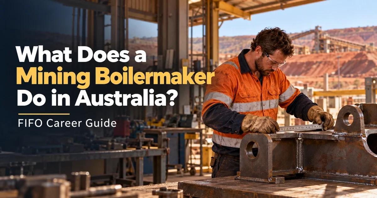
Compare mobile equipment, fixed plant and shutdown boilermaker work, check qualifications and prepare evidence for your next FIFO application.
A dated analysis of 974 live FIFO Careers jobs, including 162 disclosed pay rates, current role examples, roster comparisons and an offer-checking guide.

Compare fixed plant, NPI and underground mining electrician work, then check licences, job requirements, rosters and FIFO fit before applying.